Best Pacific Northwest Drives - Columbia River / Dry Falls Loop
Waterfalls to mountains loop
This is a stunning loop tour that can be done in a three-day weekend, as described here, or better yet in a week. It encompasses so much of the PNW’s beauty away from the coast, and the unsung “Inland Empire”. In broad strokes it starts less than 3 hours from Seattle in the Columbia River Gorge barely into Oregon, swings North through the rolling Palouse, overnights in Idaho and follows the mind-boggling paths of the Great Floods of the last Ice Age.
Day 1: WATERFALLS
From Seattle get a head start on the beauty by bearing the freeway south towards Portland. Set your GPS for the Women’s Forum Overlook. That will situate you on the historic Highway 30 which was built expressly for sightseeing in the then-new motorcars. You can continue on the narrow and twisty 30, which hopefully the RVs have bypassed on the freeway below. It will also give you your first breathtaking view.
From there drive to the Vista House that you just looked at, because why not stop, and then carry on to Latourell Falls. These are your first views of the Columbia River Gorge to help you appreciate the cataclysmic great floods of the last Ice Age. That the major events that created the stepped cliffs and gorge happened in less than 24 hours, with ice- and boulder-laden rivers travelling in excess of 60 miles per hour boggles the mend.
Latourell Falls: There is a 6-mile hike if that’s what you like, or a very easy stroll to the base of the falls.
Since the gorge was formed the water coming from the highlands has not had time to form large, classic v-shaped valleys down to the river, so you have waterfalls. A lot of them. Slowly undercutting the columnar basalt, as you see here, to make stunning free-falling cascades.
Driving on to Bridal Veil Falls is another worthy stop. This is a little more of a walk down to the falls, but a richly rewarding one.
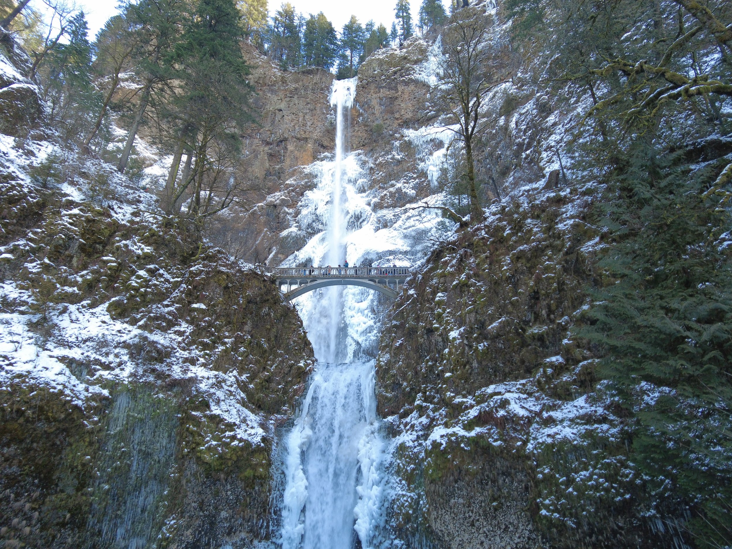
Here is a map, courtesy of the Friends of Multnomah Falls, to orient you. With sincere apologies to the Friends of Multnomah Falls … skip it. Multnomah Falls are spectacular, and their stats are top of the charts. Height, visitors, commercial operations, all off the charts. In summer you’ll need a time-bound pass just to visit. Even in winter it is a crowded spot, with Influencers telling you to get out of the way of the money-making shots. I find the other stops on this list more beautiful and more fun. Hopefully for them the Influencers got a better shot.
Multnomah Falls in winter with people
Horsetail Falls in winter
Horsetail Falls are the recommended next stop, and have a great hike up to Ponytail Falls for the active.
By now you have likely consumed most of the day and it is time to make miles. Continue north, and if you have a companion, have them read you the geologic history of the Gorge. This will come up a lot in this travelogue, so best to get it over with now. If not, the Coles Notes™ are that the Gorge was formed in something like two days by an ice age flash flood. If you have a need to reflect on your insignificance, now is a good time.
Walla Walla, Washington is a good overnight destination and fun to say several times over. Consult your preferred trip advisor™. Great food, accommodations, and wine tasting. I’ve stayed a couple of times in Dayton, which has more small-town charm. Be sure, however, to settle in for food and libations early as they seem to roll up the sidewalks shortly after nightfall. I appreciated the Victorian hospitality of the Weinhard Hotel.
Now that you are in the Palouse, more geologic history. These are sand dunes. ?!?. Since you asked, the Palouse Loess forms a fine-grained mantle of variable thickness that lies upon either the Miocene Columbia River Basalt Group, non-glacial Pliocene fluvial sediments of the Ringold Formation, or Pleistocene glacial outburst flood sediments that are known informally as the Hanford formation. At its thickest, the Palouse Loess is up to 75 meters (246 ft) thick. Thrilling. Bottom line, it’s windy. Over millions of years the wind blew a lot of dust into the dune-shaped Palouse. Lovely, and coincidentally good for wheat. A lot of it. Which is also photogenic. But you may be over it by the time you drive across its 19,000 square miles.
Here’s a 4-minute ride-along from Day 1.
Day 2: PALOUSE
Start the second day with a wonderful drive to Palouse Falls. Sometimes the journey is greater than the destination. In this case perhaps the journey is as great as the destination. From Dayton set your GPS for Palouse Falls. There is only one way to go, Highway 12 North to 261 West, and it is lovely. In summer the falls can be so overcrowded that it is pointless to try to visit. In winter (~23 deg F) I was alone. Something in between is probably best.
Geography again. Sorry. Palouse Falls was formed miles downstream, when the Missoula Ice Dam gave way and the resulting flash flood travelling at 60 mph (as fast as you on these roads!) started undercutting a lava flow that happened a wee bit earlier and worked its way back. Water, icebergs and boulders carved out their own path to the Pacific. The result is quite pleasing.
Palouse Falls in winter
Continuing North and East there are a handful of driving options across the Palouse. All look good. I choose to go back down 261 (great road) and hook up with 127 North to get to Steptoe Butte.
Palouse in winter
Palouse in summer
Steptoe Butte is a fun place to get a little perspective on the dunes of the Palouse. The butte is a 400 million year old quartzite outlier of the Couer D’Alene mountains sticking through the basalt and loess of the Palouse. A road spirals up to the top, so it is an easy visit.
Palouse from Steptoe Butte
RS4 Overlooking the Palouse
Continuing on 127 North takes you through Oakesdale, where it is worth a stop for a photo opp (rhyming prose there) at the oldest surviving wheat mill in the Palouse. Very striking, and for sale (early 2023). Ping me if you buy it.
Next stop: Coeur d’Alene. (From the French “heart of the awl”. You tell me.) Beautiful town, OK food, and lots of accommodations. Enough has been written about that.
Here is a taste of the day’s drive and sights.
Day 3: COULEES
After overnighting, set your GPS for the Grand Coulee Dam. Bing/ChatGPT will help you out if (remarkably) you haven’t heard of it. Seven wonders stuff, but only for the geeky. Like people who are into car blogs. (e.g. it is like building a sidewalk 4 feet wide twice around the equator, 50,000 miles.) Remarkably I’ve seen no Influencers here. Not into Francis turbines, perhaps. If you are travelling with a non-geek or Influencer consider skipping this stop. If you are remotely geeky go into the visitor center and ask to view the 14-minute Great Flood video in their comfy amphitheater. Admission is free, though after what you have spent on fuel so far that is not material. Pay for new experiences more than more stuff, is my advice. The video is a great explanation of how the Great Flood formed the Grand Coulee (land of superlatives) which is your next drive.
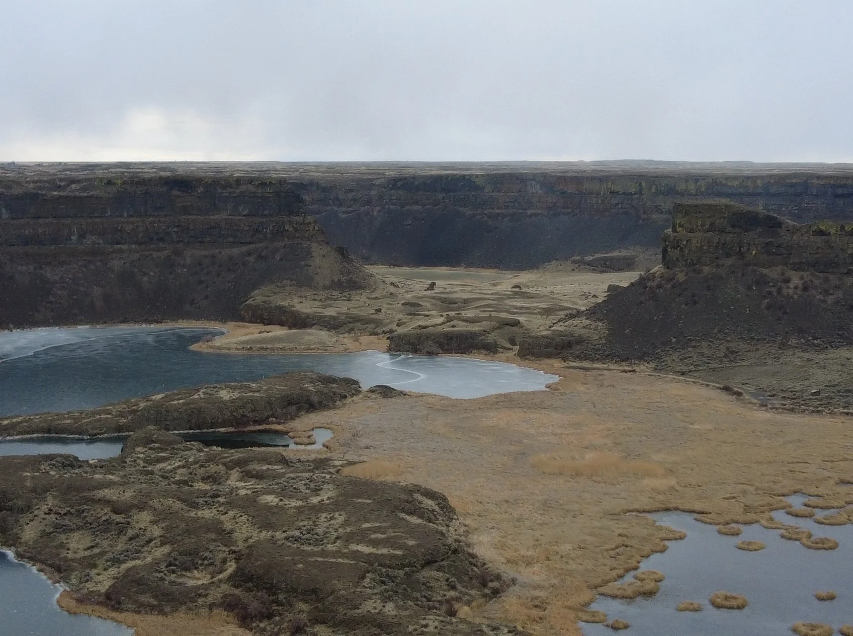
Setting your GPS for Dry Lakes State Park takes you down Route 155 along Banks Lake and through the dam’s eponymous Coulee. Your car, like a boulder encapsulated in ice, will travel at 60 mph between the scraped out gorge walls until settling out at Dry Falls, the largest waterfall in the world. Humbling.
While Dry Falls is the largest waterfall in the world, sadly you missed it. Happened 15,000 years ago. More or less. Still worth the drive, though. Like the Palouse Falls earlier, they started 20 miles downstream, and very quickly eroded their way back to the present site.
From there the three-day itinerary soon follows a well beaten path on Highway 2 out to the coast. Enough has been written about that.
General advice for drivers’ roads in the Northwest: Follow the rivers. Twisty roads follow the work that water has done to find the path of least resistance and wear away any rock in the way. Even in the lowlands. For example, after crossing Stevens Pass and getting to Sultan on Highway 2, skip the ski or summer traffic on the highway and set your GPS to turn left to take Ben Howard Road south. It may take longer or be much faster, depending on the day. Regardless, you won’t regret it. Unless you’re in an RV. I have no advice for RVs. Day 3 ends with a taste of that drive here.
As always: be safe, be courteous, and share the fun.
Technical notes:
Transport: 2007 Audi RS4, Vredestein Quatrac Pro all-season three peak tires.
Rolling shots: GoPro HERO10 Black.
Panning shots: DJI Pocket 2.
All else: Samsung Galaxy S23.
Three-day route map here.


